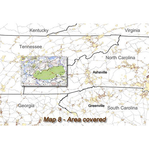
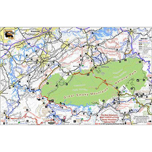
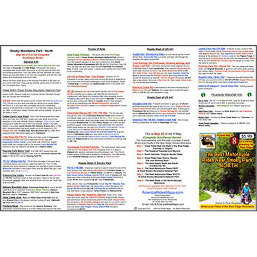
On Map #8:
- Full color map on front, detailed directions and ride descriptions on back
- Best rides boldly highlighted in red
- Good connecting roads highlighted in blue
- Closest gas stations, including remotely located stations
- Points of interest: Scenic points, waterfalls, motorcycle-friendly stops, etc.
- Easy to read color-coded road labels to aid navigation
- Mileage between road segments shown
- Overlaps and connects with adjacent maps
Cities and Towns:
Tennessee: Punkin Center, Vonure, Tellico Plains
North Carolina: Murphy, Andrews, Robbinsville, Bryson City, Highlands, Franklin, Maggie Valley, Cherokee, Hayesville, Cashiers, Cullowhee, Sylva, Dillsboro, Tuckaseegee, Glenville
Features:
- Handy, easy-to-use, accessible pocket-size - 4 1/4" x 5 1/2" and 11" x 17" unfolded
- Easy-folding
Map Description:
This map is purposely designed to help you get the most out of your rides on the busy north side of Great Smoky Mountains National Park. With some of the heaviest tourist traffic you'll find, knowing the secret back roads and short cuts through this area can turn an aggravating ride into an exhilarating adventure as you wind through the picturesque and historic foothills of the Smoky Mountains.
More than a dozen great rides are shown in red with another dozen or so good connecting roads shown in blue, as well as the best roads leading into and out of the area. This is our most detailed map of the roads and attractions within Great Smoky Mountains National Park, including the Dragon at Deals Gap, the Cherohlala Skyway, and roadside waterfalls.