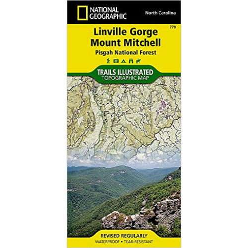
This Trails Illustrated topographic map is the most comprehensive and complete recreatioal map for the Linville Gorge and Mt. Mitchell area of Pisgah National Forest. The map shows all trails, campsites, and recreational features.
Coverage includes Pisgah National Forest, Grandfather Ranger District (complete) and Appalachian Ranger District.
Towns: Black Mountain, Marion, Morganton, Linville, Burnsville. Wilderness areas: Linville Gorge. Scenic drives: Blue Ridge Parkway. Other highlights: Mount Mitchell State Park, Grandfther Mountain Biosphere Reserve, Wilson Creek Wild and Scenic River, Brown Mountain OHV Area, South Toe River, Mountains-to-Sea Trail, and Lake James State Park.
All data is updated to reflect road closings, new trails, and campground relocation. Printed on waterproof, tear-resistant material with a plastic coating that offers supreme durability for your next outdoor adventure.
Measures Approximately 4 1/4"x 9 1/4"; folded and 25 1/2" x 37 3/4"fully opened. Scale 1:65,000